Pulpwood and log traffic on the ACR

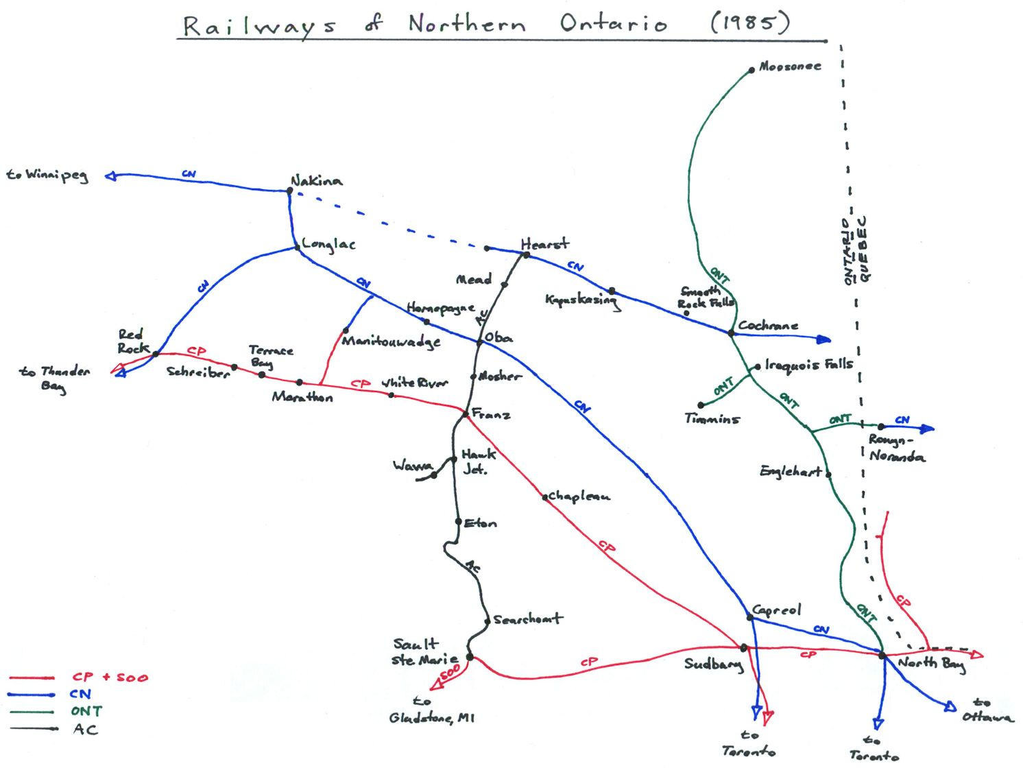
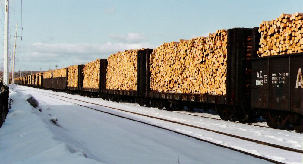
Pulpwood (that is, raw logs of a grade and size suitable for use at a paper or pulp mill) has been a staple of the ACR’s traffic since it first began construction in 1899. Large amounts of pulpwood were shipped to the paper mill in Sault Ste. Marie and much exported to mills in northern Michigan and Wisconsin as well.

Before I continue, I’d like to give a shout out to Bruce Gignac and Reg Fitzpatrick, former ACR employees who answered a few of my questions here and confirmed some information. Thanks guys!

Newaygo Forest Products

Newaygo Forest Products operated large pulpwood cutting operations north of Hawk Junction with large logging operations and loading spurs in the Mosher and Mead areas. Newaygo also had an additional spur at Trembley, just west of Wawa on the Michipicoten subdivision. Logs from Newaygo spurs were mainly shipped south for export to paper mills at Appleton and Neenah, Wisconsin.

In 1974 Newaygo established a modern sawmill at Mead to produce lumber and woodchips. While this mill was in operation, most of Newaygo’s pulp log traffic was now sent here to be turned into woodchips for export to Wisconsin (more on that later) instead of sending the raw logs south from Mosher. Logs cut around Mead were also processed at the new mill, and a couple of previously listed Newaygo spurs north and south of Mead were removed from the timetable in the late 1970s.

During the 1960s while logs were being loaded for shipment south to the US, most of the export log loading at Mosher was done at the Mosher north spur, at mile 218 (connecting to the house track and siding). After 1974, with logs being shipped north instead to Mead, most loading was done on the Mosher south spur at mile 217.3 just south of Mosher station.

Some logs from Mosher were also sent to the J.D. Levesque plywood mill in Hearst.

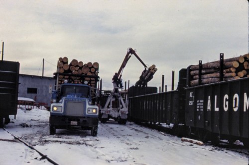
Reg Fitzpatrick also mentioned another interesting occasional movement of pulpwood from Mosher in the 1980s. Using privately owned pulpwood cars provided from Kimberly-Clark in Terrace Bay (bearing KCWX reporting marks) some pulpwood was sent from Mosher via Franz to Ontario Paper in Thorold, ON in southern Ontario’s Niagara Penninsula region. Apparently up to 15-20 cars at a time would be loaded for this service, but only three or four times a year (roughly 60 cars/year). Occasionally a rejected load from the paper mill would be sent back to the ACR and these would be sent to Dubreuilville. (Interestingly, some of these same cars were later purchased and assigned to the ACR by Wisconsin Central in the late 1990s.)

Newaygo shut down the mill at Mead and most of their other operations in Algoma County in 1985.

Abitibi Paper (later St. Marys Paper)

Providing pulpwood to the pulp mill established in Sault Ste. Marie in the 1890s by industrialist Francis Clergue (who also developed much of the other early industry in the Sault including the railway, hydro-electric power company and Algoma Steel) was pretty much the reason the line was originally driven into the forests north of the Sault. Originally a component of Clergue’s Consolidated Lake Superior Corporation, in later years the mill was operated by Abitibi Pulp and Paper, and later independently as St. Marys Paper. Its fortunes declining, the mill closed down for good in 2007 and has since been demolished, except for some of the original heritage structures from the late 19th century.

M_Turney16_1995

A southbound freight arrives at Steelton yard in the early 1980s with a significant amount of pulpwood, likely for the Abitibi Paper mill. Morgan Turney photo.

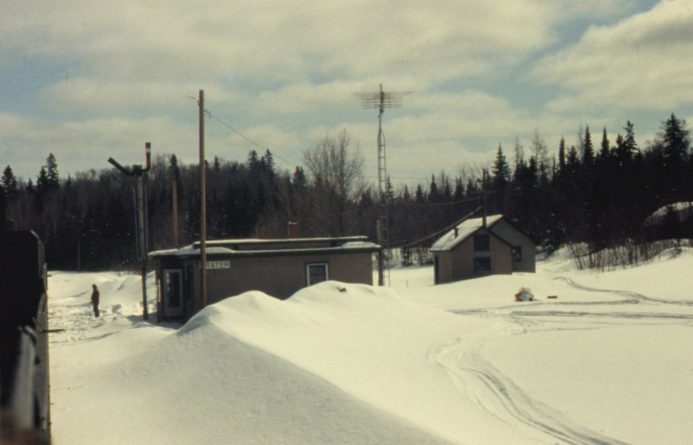
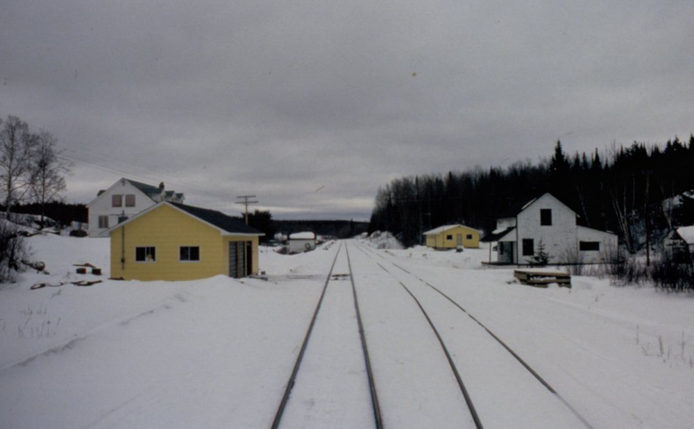
Several different spurs owned and operated by St. Marys Paper are listed in the official employee’s timetables, with notable operations at or near Millwood (just north of Agawa siding), Limer and Trembley. This however, doesn’t necessarily tell the whole story, as quite often pulpwood was also loaded at the house track at several different sidings along the line, and this wouldn’t be additionally listed in the timetable. Batchewana, Mekatina, Regent and Frater are a few sidings definitively known to have hosted significant pulpwood loading operations, usually by private contractors but in many cases shipping to St. Marys Paper.

Other

In addition to Newaygo and St. Marys Paper, probably the biggest shippers and receivers of pulpwood on the ACR, several other mills on the ACR also received logs by rail.

In Searchmont there was a veneer mill operated by Weldwood Canada (later G.W. Martin). Log spurs operated by the same company were located at Eton. This mill shut down around 1990.

In Sault Ste. Marie there was a lumber & veneer mill operated by Weyerhauser in the early 1980s. (Originally established in 1948 as Roddis Lumber & Veneer, and sold [by Weyerhaeuser] to G.W. Martin in the mid 1980s, and later to Lajambe Forest Products, Agawa Forest Products (E.B. Eddy) and Domtar, and still operating today as Boniferro Mill Works). This mill likely received logs from a few locations, and there was a Weyerhaeuser spur at Achigan (mile 42) during the early 1980s (spur listed under G.W. Martin in the late 1980s). I’ve seen a number of photos such as the one below with loads of larger logs, mostly shot in or near Sault Ste. Marie. I’m guessing that the Weyerhaeuser mill is a likely destination for these although I honestly don’t know for certain. I’m not sure where these logs are loaded either, but this very nice Dave Beach photo shows that at least some of them come from north of Montreal Falls (mile 92).

M_Turney19_1995

The Steelton yard switcher shuffles a cut of cars of logs. Early 1980s photo by Morgan Turney.

After the Wisconsin Central takeover in late 1995 or early 1996 a new oriented strandboard (OSB) mill opened at mile 153 north of Perry siding. Video and photos that I’ve seen do show that logs were shipped here by rail in AC flatcars, but I’m not sure where from. This mill closed sometime around 2007 due to the general decline in the northern Ontario forestry industry in the early 21st century.

The sawmill at Dubreuilville did not general receive much in the way of logs by rail, as their cutting rights were close to their mill and mostly delivered by truck.

scan0009

Loading pulpwood on the team track behind the freight shed at Hawk Junction, March 1981. Photographer unknown, slide in my collection.

In addition to isolated spurs owned or operated by specific companies as above, there are several smaller logging companies that show as operating their own spurs – these smaller companies would likely have sold their logs to the area mills in Searchmont, the Sault or Michigan. Also as mentioned above in the St. Marys Paper section, a lot of pulpwood was loaded at house tracks at various locations and wouldn’t be reflected in the “Loading Spurs” section in the timetable.

SAMSUNG DIGIMAX 360

Pulpwood flatcar owned by Besse Forest Products. Besse operated a loading spur beside Steelton Yard in the early 2000s for export pulpwood. At Sault Ste. Marie in August 2004. My photo.

Columbia Forest Products was another company that had a pulpwood loading operation on the ACR’s property behind the Steelton car shops in the late 1990s and early 2000s; Columbia also operated the plywood mill in Hearst from 1995, and presumably these logs loaded in Sault Ste. Marie would have been shipped north over the railway to the mill.

Operations Today

Today the paper mill at Sault Ste. Marie and various forest products mills at Searchmont, Limer, Dubreuilville and Mead are all closed, but there is still some loading of pulpwood for export to Michigan and Wisconsin.

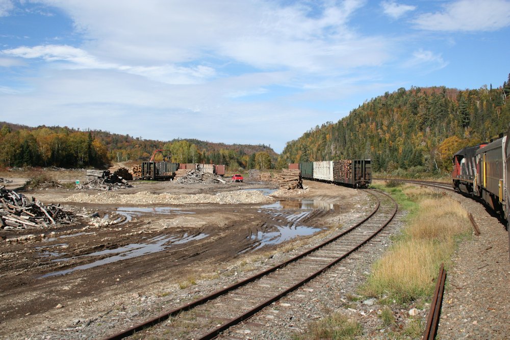
When I rode the tour of the line to Hearst in 2013, I noted active operations at Odena (mile 10), Eton (mile 120) and Langdon (mile 240, just south of Oba). This summer I also heard southbound freight 574 on the radio doing some switching of log spurs at or near Regent siding (mile 89).

IMG_7496

Log spurs at Eton, September 30, 2013. My photo.

There’s also some current movements of pulpwood from one of the spurs/sidings (not sure which) on the former ACR to somewhere in Quebec (I’ve not yet been able to determine exactly where these are going). These travel up to Hearst where they are routed over the Ontario Northland into Quebec via Rouyn-Noranda.

Also, across town at the Huron Central yard, pulpwood is loaded for shipment to the Domtar mill at Espanola. While this is not really related to the ACR per se, I’m not sure if logs for this mill were also loaded at locations along the ACR at times as well.

Operations Series

Over the next several weeks, I’m beginning a series of posts looking at some of the operations of the former Algoma Central railway, with each post focusing on some particular commodity and/or facet of the operation. Generally speaking, the posts will roughly cover historical and current operational information from about the 1970s to today.

As this series progresses, if anyone reading has further information that expands, illumines, adds to, corrects my information, or even flat out contradicts an assumption I’ve made, please do comment on the post or send me an email! I’d love to be able to flesh out any gaps or errors in my knowledge.

As a preliminary overview, one should understand the geography of the area, and how the ACR fits in to the other railways in the region. This map shows the railways in Northern Ontario in the mid 1980s.

regionalmap

(Click on the map for larger image)

The Algoma Central is the black line running vertically in the centre of the map. Important interchanges for traffic exchanged with other railways are located at Franz (Canadian Pacific), Oba (Canadian National), Hearst (CN and by extension Ontario Northland) and Sault Ste. Marie (SOO and CP). All of these points are extremely important for traffic coming onto or off of the ACR.

A quick rundown of changes that have been made to the map between 1985 and today:

  • The CN line between Longlac and Thunder Bay has been abandoned
  • The CN and CP spurs to Manitouwadge have been abandoned
  • The CN line between Nakina and Hearst (except for a few miles between Hearst and Calstock) was abandoned in 1986
  • The CN line between Hearst and Cochrane, including the spur to Calstock was sold to Ontario Northland in August 1993
  • The CN line east of Cochrane to Seneterre, QC has been abandoned between Cochrane and La Sarre, QC
  • The CN line between Capreol and North Bay, and North Bay to Ottawa has been abandoned
  • The Algoma Central was sold to Wisconsin Central in February 1995 which was then purchased by Canadian National in October 2001
  • The AC branch line to Wawa was abandoned in 2000
  • The SOO Line trackage in Michigan connecting to Sault Ste. Marie was sold to Wisconsin Central in 1987, then CN
  • The CP line between Sault Ste. Marie and Sudbury is now operated by Huron Central Railway (G&W) since 1998
  • The CP line between Sudbury and North Bay, plus the branch line to Temiscaming, QC is now operated by the Ottawa Valley Railway (RaiLink, now G&W)
  • The CP line from North Bay to Smiths Falls has been abandoned east of the Temiscaming branch as of 2011

All posts from this series:

Notes on an Old Slide Collection

Earlier this summer I acquired a small collection of ACR images from an individual in the states. The slides appear to have been primarily taken on the occasion of a railfan visit to the Algoma Central, and while of varying quality, contain some interesting content. The photographer appears to have gotten a cab ride (in a trailing unit) on both a northbound and southbound freight over the Soo subdivision, a caboose ride on an ore train on the Michipicoten branch and on the Northern sub (at least as far as Franz).

None of the slides were marked for location, date or photographer’s name, making identification a little interesting in some cases. However most of the slides had numbers written on the slide mounts allowing them to be put into proper sequence, at which point a story unfolded and certain views could this be related to each other. My own ride on the Tour of the Line at the beginning of October also helped to familiarize myself with the line and I could thus confirm a few of the location identities.

While the slides are undated, a few items have allowed me to date the images to the winter of 1980-81 with a pretty high degree of certainty. One image in the collection is of baggage car 211, which was renumbered 302 in the spring of 1981 with the arrival of the 200-205 series GP38-2 locomotives. Another image of the ACR’s scale test car clearly shows a 5-80 reweigh date on the car, which pretty nicely brackets the time frame of the images to a specific year.

The background thus identified, here follows a few selections of interest, in no particular order.

scan0015

Steelton, Winter 1980/81. Photographer unknown, Chris vanderHeide collection.

Scale house at Steelton yard. The ground level window on the rear of the structure seems an odd feature. In the background is the ACR’s sprawling Steelton yard and the Algoma Steel Corporation mill. Several AC freight cars including one of the ACR’s unique 61′ bulkhead gondolas, an even more unique curved side “bathtub” style hopper and a covered gondola for coil steel service are visible.

scan0017

Frater, Winter 1980/81. Photographer unknown, Chris vanderHeide collection.

Frater station. In deep snow with snowmobile tracks all over. There are other better photos of the station building at Frater available online, but this nicely relates the station to the two small outbuildings behind. The station has long been torn down, but those two small structures still exist today. The grey structure appears to have been converted into a small cabin; note the new “bay window” added to the front of this structure, which appears to be salvaged material from the station.

IMG_7462

Frater, Sep 30, 2013. Chris vanderHeide photo.


scan0008

Frater siding, winter 1980/81. Photographer unknown, Chris vanderHeide collection.

The location for the above photo would appear to also be at Frater, just south of the station, showing a northbound freight running along the shore of Frater Lake. Note the long string of CP 40′ boxcars in the train; at least a dozen can be counted before the train curves away. Likely these are empties heading back to Schreiber on the CPR for woodpulp loading. This is an interesting photo for highlighting the volume of this traffic over the ACR.

scan0014

Franz, winter 1980/81. Photographer unknown, Chris vanderHeide collection.

Crossing the CPR at Franz, riding in the caboose of a northbound freight. More CP 40′ boxcars are spotted in the interchange track; one is painted in green which signified newsprint service. All of the cars seen here are probably 8′ door cars (all the newsprint assigned cars were 8 footers) in service hauling woodpulp from mills along the Lake Superior north shore.

Speaking of Franz, here’s a look southward off the rear of that caboose:

scan0013

Franz, winter 1980/81. Photographer unknown, Chris vanderHeide collection.

All of the structures visible in the above photo, except for a small white speeder shed roughly in the centre of the photo, still stand today. The station at Franz was closed in 1992 with the end of train order operation on the ACR, and ended up being moved to the community of Dubreuilville.

scan0016

Perry pit, winter 1980/81. Photographer unknown, Chris vanderHeide collection.

The above photo was tentatively identified as the ballast pit just north of Perry siding, based on the excavated appearance of the embankment in the background and its sequence number and relation to other images/locations. This was able to be conclusively confirmed when I rode the ACR passenger train on the last day of September and easily recognized the location.

The above images makes it a little unclear whether any ballast was still quaried from the gravel pit here during the 1980s, but interestingly there was clearly quite an active pulpwood loadout here during this time frame.

Perry pit today, the rails for the spur are still there, but the main track switch has been removed and the site is abandoned:

IMG_7536

Perry pit, September 30, 2013. Chris vanderHeide photo.

scan0007

Millwood, winter 1980/81. Photographer unknown, Chris vanderHeide collection.

A simple passenger shelter at Millwood (mile 212.9). Simple shelters like this were erected at several flag stop locations along the line.

That’s all for tonight, probably more to come periodically.

Ideas for Adapting a Tonnage Rating for a Model Railway

Tonnage ratings are, put simply, a table of figures detailing the maximum tonnage a single locomotive of a particular type can handle across a railway or portion thereof. While certainly not the only consideration when applying power to a train (for example, in addition to tonnage ratings, some railroads may also specific a minimum horsepower per ton for specific trains, with priority fast freights given higher horsepower ratings to ensure quick movement), tonnage ratings are an important tool to make sure a train has at least the minimum amount of power (locomotives) to make it over the line.

Tonnage ratings are broken down by locomotive class (usually grouped by horsepower), and will vary on different portions of a railway based on ruling grades and curvature. The ratings are also listed separately in each direction over a portion of the railroad since uphill ruling grades will vary. For every class, there are three ratings listed, an A (best possible conditions), B and C (really miserable conditions like rain or ice making things really slippery) rating. The ratings are given on a per-unit basis; to know how much tonnage a particular consist can handle, you just add up the tonnage ratings for each unit for the overall rating.

Below are the actual ACR tonnage ratings copied from the 1982 summer employee’s timetable. It’s a bit of a dizzying wall of figures, and I’m not going to study the entire thing in detail, but the figures aren’t too difficult to interpret.

As a simple example, let’s say you have a 9000 ton train to haul from Hawk Junction to Hearst, and that conditions are good, so we’ll use the A rating. (We won’t worry about adding or dropping cars enroute.)

Looking at the table, we can see that a pair of SD40s will handle this nicely. (2units x 4620tons/unit = 9240)

However 2 GP38-2 units only have a combined tonnage rating of 6880, well under the 9000 tons we need to move, so we need a 3rd unit, which will bring the tonnage rating to 10320 if all three units are GP38-2s.

If all we have on hand are GP7s, 3 units at 2950tons/unit only gets us to 8850, so we’d need a fourth unit.

Of course we can mix and match units and just add up the tonnage ratings for each unit, the examples are just easier with similar units.

Table 1: ACR Tonnage Ratings from Timetable #139, May 29, 1982

GP7 GP9, GP38-2 SD40, SD40-2
A B C A B C A B C
Northward:
Steelton-Goulais 1600 1490 1440 1865 1740 1680 2510 2330 2260
Goulais-Frater 1250 1160 1125 1460 1350 1310 1960 1825 1765
Frater-Hawk 1500 1395 1350 1750 1625 1575 2350 2185 2115
Hawk-Hearst 2950 2745 2655 3440 3200 3100 4620 4300 4160
Southward:
Hearst-Hawk 3100 2890 2790 3615 3370 3255 4800 4450 4320
Hawk-Mekatina 1400 1300 1260 1630 1515 1470 2170 2020 1955
Mekatina-Goulais 1550 1440 1395 1810 1680 1625 2400 2230 2160
Goulais-Steelton 1650 1535 1485 1925 1790 1730 2560 2380 2305
Westward:
Hawk-Siderite 1350 1255 1215 1575 1465 1415 2120 1970 1910
Siderite-Brient 1800 1675 1620 2100 1955 1890 2820 2620 2540
Eastward:
Brient-Helen 1000 930 900 1165 1085 1050 1550 1440 1395
Helen-Hawk 1430 1330 1285 1670 1550 1500 2220 2065 2000

There are two things I’d like to draw your attention to in the table.

  • Note the extremely low numbers eastward out of Brient (Brient was the yard that served the harbour at Michipicoten, at the terminus of the Michipicoten branch), barely better than half of the westward ratings for the same portion. From the harbour at Michipicoten to Wawa is an almost continuous upgrade, and the steepest grades on the railroad are found near Brient on the descent to the Lake Superior shoreline, reaching 4% between the former Brient yard and Michipicoten.
  • Note also the huge disparity between the tonnage ratings north of Hawk Junction and the rest of the railway. North of Hawk Junction, and away from Lake Superior, the terrain flattens out considerably, and this is clearly reflecting in the more favourable tonnage ratings.

So where do we go from here?

The first thing is that these are tonnage (weight) ratings, not car counts. Unless your passion is number crunching, something that uses a simple car count instead of adding up differing tonnages for each car is probably a much preferable system for determining engines to train length.

The other issue is that on the model railroad, we try to weight our cars consistently so they operate well on our tighter-than prototypical curves and generally steeper than average grades (especially helices). There’s really not much of a difference between the weight of a load or empty.

While there have been articles published about methods scaling down prototype weights for the extra realism, and manipulating this table is actually kind of fun as an academic exercise, during an operating session I would prefer a quick an simple way of just looking at the train length to determine how many engines are required.

The simplest thing to do on a model railroad would be to take a representative unit, stick a bunch of cars behind it and run it up the ruling grade on the layout (quite likely the helix if your layout has one.) Find out how many cars a single unit can pull and use that as a baseline to say you can have, for example, up to ten cars per engine on a train. If your layout is flat, or your grades are very gentle, you might arbitrarily set your car counts to have something that looks good (or just not worry about it too much, and just say, “Yeah, that looks about right for this layout” – although really that’s pretty much the same thing, just without writing down an actual “rule” for it.) There’s not really a wrong way of doing it, as long as the engines can handle the size of the train.

Finally, model locomotives tend to be a lot more equivalent; a model SD40-2 isn’t twice as powerful as a model GP7; more likely they’re pretty equivalent. Depending on the brands or makes of the models, the GP7 could even be a better puller than the SD40! So to make the SD40s look more powerful, we institute an artificial restriction on the GP7s, maybe something as simple as “10 cars per 6-axle unit, 8 cars per 4-axle unit” to force the use of more smaller units to replace a pair of bigger ones, instead of having 2 GP7s do the same work as 2 SD40s.

The interesting thing about the ACR tonnage ratings is that huge disparity mentioned above between the flatter Northern subdivision north of Hawk Junction and the rest of the railway, which stays much closer to the rocky shores of Lake Superior. However, when I get to the point of actually building my ACR layout, which will be based on the Northern and Michipicoten subdivisions, I don’t imagine that grades on the (model) Northern sub. will be appreciably different than on the Michipicoten branch. In fact, depending on the layout design and inclusions of helices to double deck the layout or lengthen the run between stations, the ruling mainline grades could actually be between Hawk Junction and Hearst.

However the prototype tonnage ratings show that trains leaving Hawk Junction to the north should have a higher power/car ratio than trains heading south to Steelton (Sault Ste. Marie) or Wawa/Michipicoten. While the model version won’t really have the same characteristics, I can fake by decreeing artificially lower car counts/engine for the Michipicoten and Soo subdivisions. The last will likely just be staging, but trains leaving the modelled yard at Hawk Junction should “look right.”

As an exercise, I took the “A” rating column* for each class and divided the all the numbers by 125 tons. 125 tons is the approximate gross weight of a fully loaded 100 ton capacity car (like the ACR’s 100-ton open hoppers). But except for (loaded) ore trains, the average car in the 1980s was more like 70-ton capacity, and of course empties are much lighter. So this has the quite deliberate effect of already forcing car counts down.

* Since I probably won’t be modelling much of the Soo subdivision south of Hawk Junction, I only included north of Frater, and to simplify the Michipicoten branch, I split it at Wawa instead of Siderite, since Wawa and Michipicoten will probably be the only actually modelled locations on the branch.

The interesting thing about dividing by 125 (the weight of a loaded ore car) is that on the Michipicoten branch in the 1980s, the traffic was pretty much all loaded hoppers eastward, empties westward; so this actually gives a pretty good picture of the power required for loaded ore trains; 3 SD40s or 5 GP7s for a 36-car train of loaded hoppers. The westward car counts could actually be much higher since the cars would all be empties, but you also have to provide enough power to account for bringing the loaded train back!

After dividing by 125, I multiplied everything by .6 (somewhat less than 2/3) to scale things down a bit more, and simply rounded everything off to whole numbers. This already produces some interesting results, but some numbers are a bit high yet and may need to be artificially downgraded yet, but it’s an interesting place to start. Let’s take a look:

Table 2: “A” ratings, divided by 125tons and scaled down by .6

GP7 GP9, GP38-2 SD40, SD40-2
Northward:
Frater-Hawk 7 8 11
Hawk-Hearst 14 17 22
Southward:
Hearst-Hawk 14 17 23
Hawk-Frater 7 8 10
Westward:
Hawk-Wawa 6 8 10
Wawa-Michipicoten 9 10 14
Eastward:
Michipicoten-Wawa 5 6 7
Wawa-Hawk 7 8 11

This does some interesting things, which are easier to see with the smaller set of smaller numbers. The counts for the portion from Hawk Junction to Hearst are almost exactly double everything else, and things are pretty consistent in both directions, except between Wawa and Michipicoten where some really interesting things happen. Remember it’s basically entirely uphill from Michipicoten to Wawa.

Those Hawk-Hearst numbers remain pretty high, and now it’s really clear how much easier the north end of the railway is compared to the south. I don’t think a single model SD40 will handle 23 cars up a helix! I’ll need to limit things more on the Northern sub, so my ratios are never going to be quite double like the numbers above.

Here’s what happens when I scale everything a factor of one half, instead of .6:

Table 2: “A” ratings, divided by 125tons and scaled down by .5

GP7 GP9, GP38-2 SD40, SD40-2
Northward:
Frater-Hawk 6 7 9
Hawk-Hearst 12 14 18
Southward:
Hearst-Hawk 12 14 19
Hawk-Frater 6 7 9
Westward:
Hawk-Wawa 5 6 8
Wawa-Michipicoten 7 8 11
Eastward:
Michipicoten-Wawa 4 5 6
Wawa-Hawk 6 7 9

That produces something interesting. Just reading numbers off of this and using the same car counts in both directions pretty much gives max car counts of 12/14/18 (for GP7/GP38/SD40 respectively) between Hawk Junction and Hearst, and 6/7/9 everywhere else except for the extreme restrictions on the grade out of Michipicoten. But even that’s pretty reasonable: 3 SD40s handling a max of 18 cars (include the caboose in that) which is a decent sized train on a model railroad and would look pretty spiffy.

The Hawk-Hearst numbers will need to be scaled down more based on the realities of model locomotive performance, but the rest looks pretty reasonable, at least on paper.

Will I adopt these car limits as-is? Ultimately probably not exactly, but it’s an interesting place to start and hopefully something to generate some good discussion!