While along its route the ACR runs alongside many lakes and rivers, just south of the station and siding at Mosher, the Algoma Central skirts the shores of Oba Lake, and here is found one of the more interesting features on the railway that is rarely photographed.
As the line hugs the shoreline of this large lake, it cuts directly across the mouths of several bays on a series of causeways and trestle bridges.
You can see the line cutting directly across these bodies of water in the satellite image below:

While not as spectacular as the iconic 1550′ curving steel viaduct over the Montreal River and power dam at Montreal Falls, or even the 800′ long trestle at Bellevue, these bridges are an interesting feature, and the longest of these bridges is nearly 1200′ in length (not including the approach causeways) and mere feet above the surface of Hoodoo bay.
All three of these trestles were wooden pile-bent construction. (Although the longest bridge has since been upgraded, but more on that later.)
According to the stories, when these bridges were first built across these bays, the ACR engineers found themselves driving piles into nearly “bottomless” mud and muskeg, and the bridge piles apparently “float”, held up by the friction of the pilings in the mud rather than any solid foundation. All trains cross these bridges at a severely restricted speed of 20 MPH, and the conductor on our train when I rode the line in October mentioned that if one were actually standing trackside when a train passes, you can actually visually see the bridge deflect by at least 6 inches!

This excerpt from a 1996 Wisconsin Central track chart shows the area of the three bridges, located at mileage 211.9, 212.4 and 214.2 respectively. Lines at the top of the chart indicate the curvature and grade of the line. The railway is shown as a straight line with marks and notations indicating the location and length of each bridge and culvert, as well as the details of their construction.
For example, the first trestle has the following notation above the mark indicating its location:
211.90 31 SP PB
424′ LONG
The “211.90” is the mileage of the bridge. The “424′ LONG” is obviously pretty self-explanatory. The “31 SP PB” is a little more cryptic, but this indicates the construction of the bridge: a 31 span (SP) pile-bent (PB) trestle.
You can see the notations along the bottom of the chart indicating the speed limits for this section of the railway, note the 20 MPH limit for all trains over the bridges.
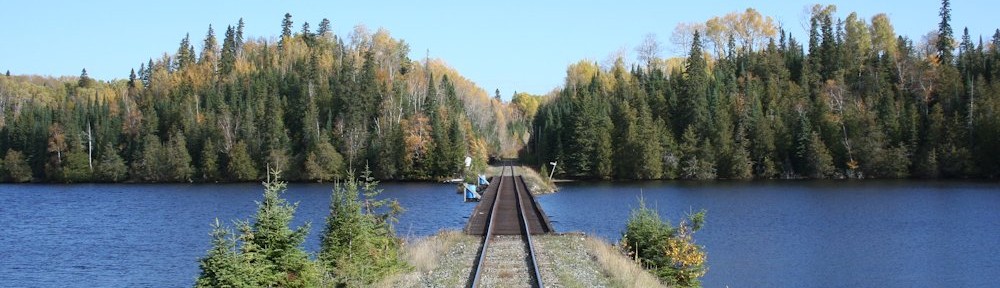
Mile 211.90 Bridge

The first trestle is the 424′ long wooden pile trestle at Mile 211.90.

Note the lack of guard rails on this trestle, which you’ll also see on the other wooden bridge at Mile 214.08.

Milepost 212 is located on the approach causeway just north of the end of the actual trestle.

At the north end of the causeway is a stop for Woods Camp, one of many such remote wilderness camps along the ACR. In addition to this small shed, just down and to the left out of frame is a small floating boat dock (the actual camp is located somewhere else on Oba Lake and accessed via water).
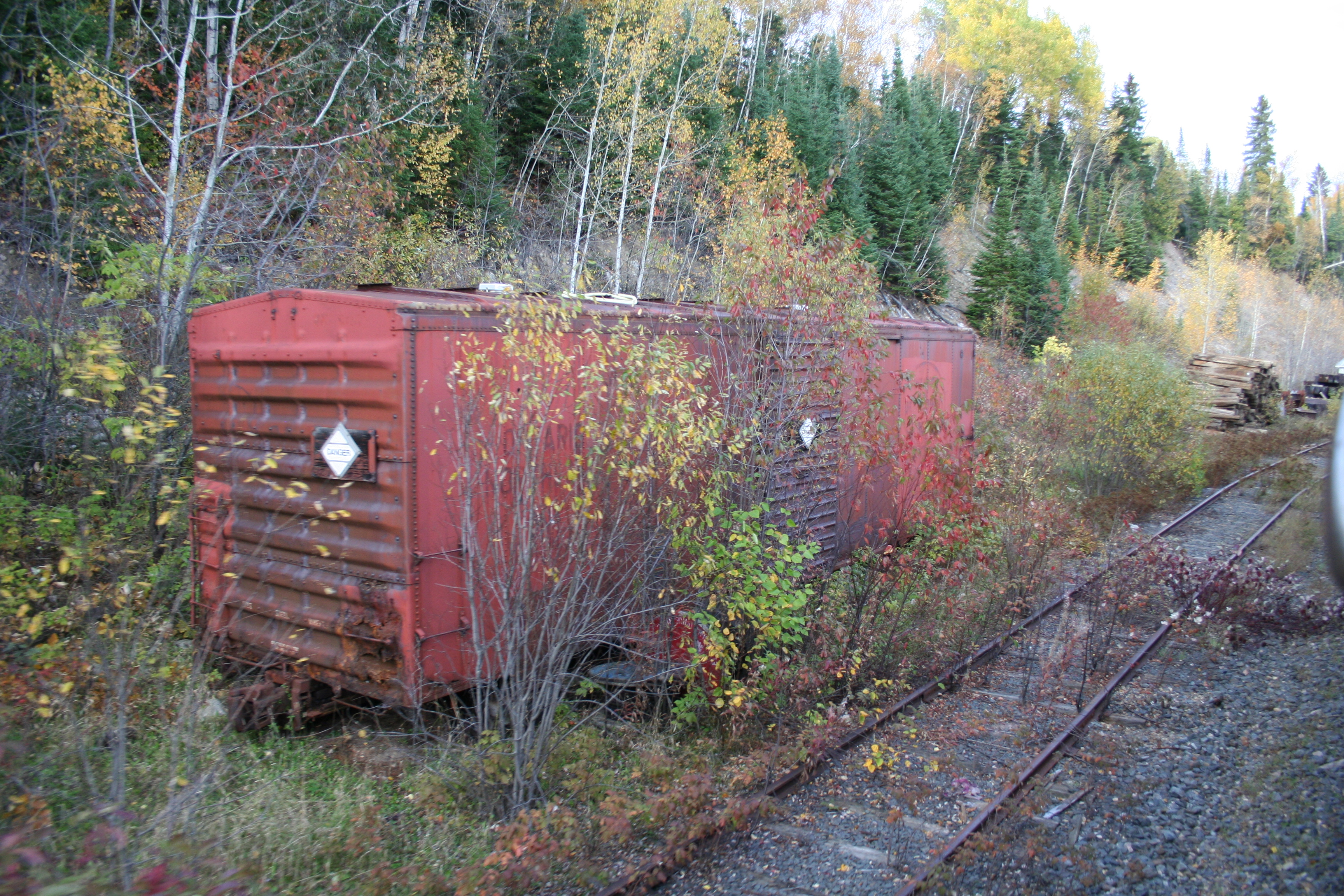
Mile 212.4 Spur
Between the first and second bridges is this short little maintenance spur for storing supplies and work equipment when maintenance is being performed on these trestles (this is a very remote area).

This isn’t shown on the track chart above, but is listed in old timetables from as a 7-car company spur, and is clearly still in place today (as shown in these 2013 photos).
All around this area were stored fresh timbers and supplies for maintaining the wooden bridges, plus a couple of big piles of ruined ties that have been removed and replaced on nearby track.

In the weeds at the south end of the spur is an old ex-Ontario Northland boxcar used for a storage shed.
Mile 212.70 Bridge
At nearly 1200′ in length not including the approach causeways at either end, this is the longest of the three bridges at Oba Lake. At some point in time, this bridge has been replaced with a new bridge with steel pilings with concrete caps supporting the bridge spans.
The original bridge would have looked identical to the other two, other than the much greater length.

The southern approach to the bridge, looking north with Hoodoo Bay to the right. Note the obvious widening of the roadbed to the left for the original alignment of the old bridge.
When crossing over the bridge, the wooden pilings for the original bridge can be seen on the left side, although the water level in the lake was high when I travelled in October, so the tops of the pilings were just below the surface of the water and are not visible in any of my photos. They were quite visible in person however, and I’ve seen other photos where the water level is lower and the tops of the pilings do stick up above the surface.

This photo is taken roughly at the mid-point of the bridge.
With the upgraded bridge, the train was able to travel a bit faster than the 20 MPH restriction on the other two entirely wooden bridges.


Detail of the abutment at the end of the bridge.
You can just see the ends of the concrete caps on the pilings which support the new bridge spans.
The horizontal timber at the water’s surface is evidence of the original wooden bridge.

Again note the widened causeway on the north end of the bridge. The original alignment would have been to the left.
Mile 214.20 Bridge
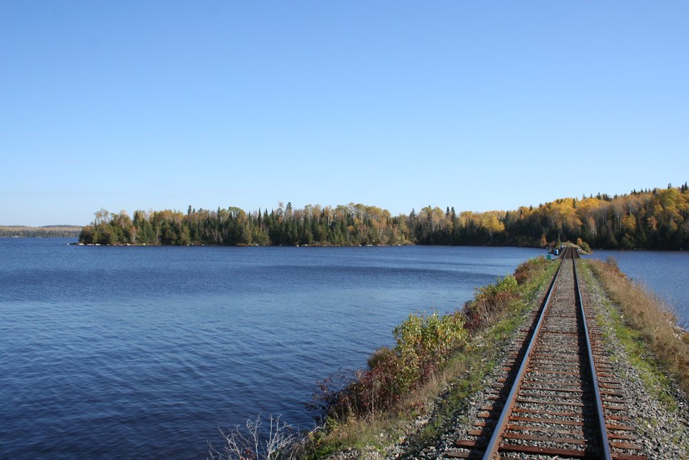
And lastly, the third bridge at Oba Lake is this 445′ bridge at mile 214.2. The construction is again identical to the first.

The bridge at Mile 214.2, with the track curving away on the causeway on the north end to run along the shoreline.

Just under a mile north of the last bridge is one final causeway that completely cuts off another small bay of Oba Lake. This is also clearly visible on the satellite image at the top of this post.
While it would certainly not be feasible to model all three of these bridges, and certainly not to full scale (the longest bridge would be over 13 1/2 feet long in HO scale just for the bridge, not including the approach causeways and even the two shorter bridges would be at least 5 feet long) I’d definitely like to include a representation of at least one of these bridges south of Mosher on my eventual layout, as I think the long, low trestle running just 10 feet above the surface of a quiet lake will make a great model scene.
On my next layout I want to model this! I think that it would look terrific! Great PICS! I hope to be on the ACR this summer.
Nick
Thanks Nick. The photos were all taken out the back door of the passenger coach on the southbound regular train, CN P632.
I think at least one of these bridges, being a long, low wooden trestle across open water will make a pretty unique scene.
Thank you for this article.